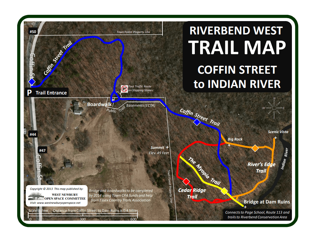
In 2010, a public trail easement was added to a development on Coffin Street, providing access from Coffin Street to the Indian River Dam Ruins, a very scenic and historical spot in the heart of this forest.
***Trail Alert***
During the Spring thaw as well as during periods of heavy rain these trails can become flooded.
Riverbend West Trails:
A new trail network was added in 2013 connecting Coffin Street to the Indian River Dam Ruins. This trail features a 50′ boardwalk crossing wetlands thru a newly acquired public trail easement. The Myopia, Cedar Ridge and River’s Edge Trails merge at the bridges crossing the Indian River, where the former dam and dike is located. Named in honor of the high school seniors who carried the bridge materials to the site, the Pentucket Trail provides a direct, albeit steep, route up to the Page School with better access to Route 113. The boardwalks and bridges were built by SCA AmeriCorps in July 2014 using Town CPA funds.