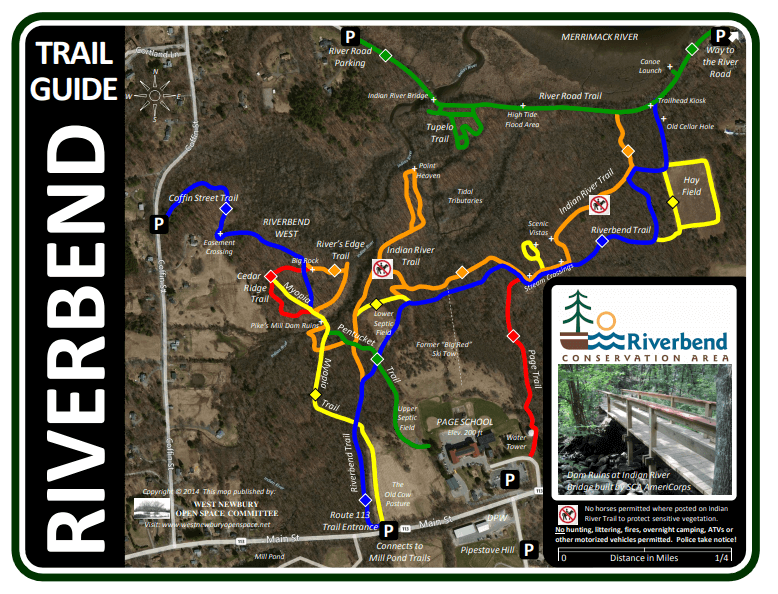
Riverbend Trail
- From Mill Pond’s upper parking lot, cross Route 113 to enter the trail.
- The old cow pasture that the trail passes through was part of a dairy farm used by Mingo family, who purchased the land in the 1930s.
- The property was previously owned by E. Moody Boynton, who was the inventor of the crosscut saw and monorail.
- The trail crosses several stonewalls built by settlers in the 17th and 18th century.
- Just below the Page School are the remains of a ski tow that was used from 1960 to 1972.
- The trail travels east and links to a large hay field, ideal for cross-country skiing and horseback riding.
- The old cellar hole is the former Griffin Home Site built in 1729. Rumors have it rumrunners used the foundation hole during prohibition.
River Road Trail
- The River Road Trai an ancient trail once used by Native Americans to reach summering grounds on Plum Island.
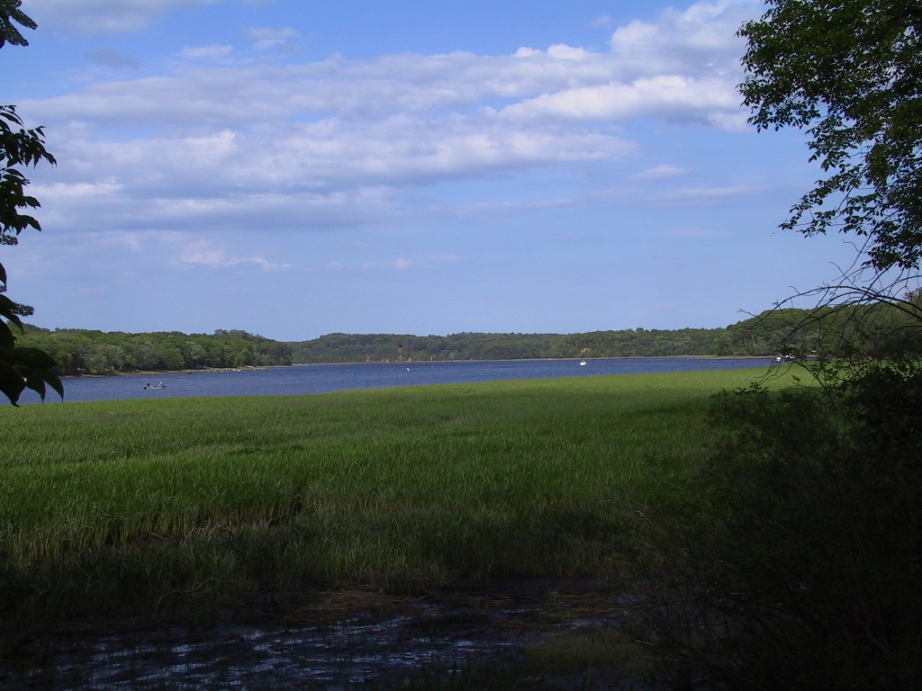
- Rare wild rice paddies can be seen growing along the Merrimack River.
- The bridge spanning the Indian River was built in 1999 and allows foot, bicycle, and equestrian crossings.
- The Tupelo Trail, which is off the Riverbend Trail, provides a beautiful, quick visit to one of the most scenic places in West Newbury any time of year.
Indian River Trail
- This trail begins at the Merrimack River and meanders through the Riverbend Forest to the Indian River.
- The trail follows rare freshwater tidal estuaries, first protected in 1686 to “be free as far as the tide flows for the passing and re-passing of boats and canoes.”
- The trail passes through virgin stands of oak and beech trees and reaches a scenic point once used by Native Americans as a canoe stop and campsite.
- The trail ends at the remains of a former sawmill and dam, built by Sargent Joseph Pike in 1706.
- To help protect sensitive vegetation, no horses are permitted in certain areas of this trail.

Page Trail
- From Pipestave Hill’s parking lot, cross Route 113 and enter the trail next to the water tower.
- The trail is fairly steep as it goes down the hill, where it eventually joins the Riverbend and Indian River Trails.

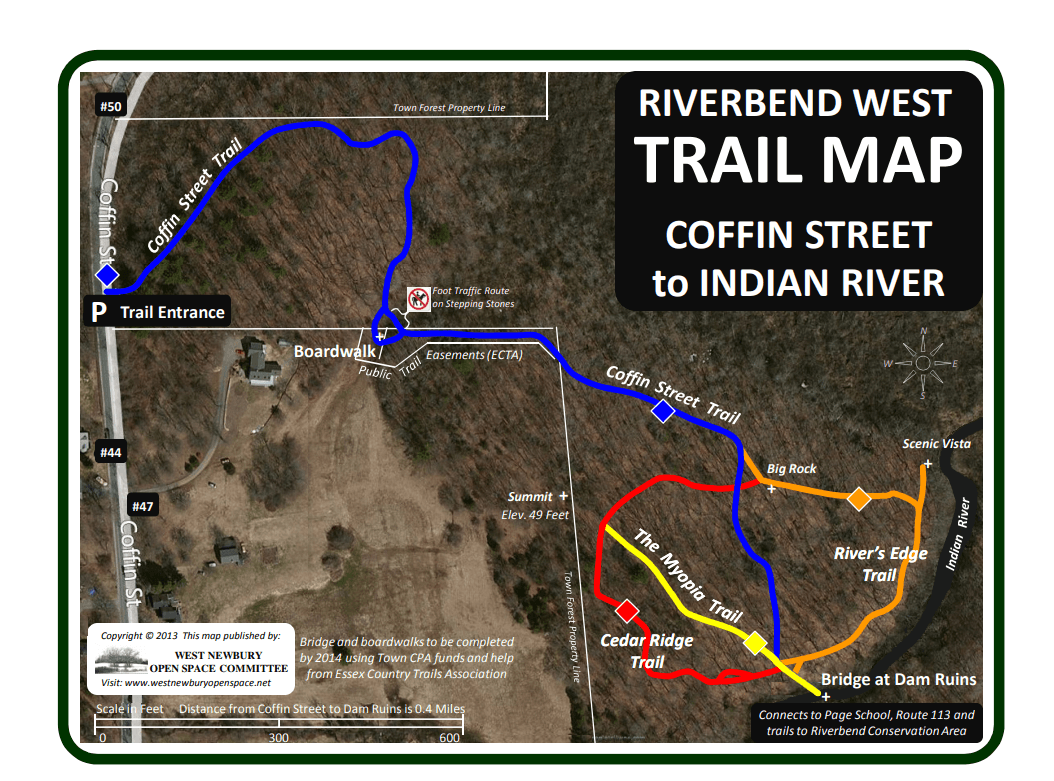
Myopia Trail, Cedar Ridge Trail and River’s Edge Trail
- A new trail network was added in 2013 connecting Coffin Street to the Indian River Dam Ruins.
- This trail features a 50′ boardwalk crossing wetlands through a newly acquired public trail easement.
- The Myopia, Cedar Ridge and River’s Edge Trails merge at the bridge crossing the Indian River, where the former dam and dike were located.
- Named in honor of the high school seniors who carried the bridge materials to the site, the Pentucket Trail provides a direct, albeit steep, route up to the Page School.
- The boardwalks and bridges were built by SCA AmeriCorps in July 2014 using Town CPA funds.